‘Putting Pluto’s Geology On The Map’Image credit: NASA/JHUAPL/SwRI; text credit: T
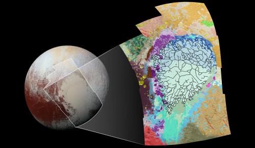
‘Putting Pluto’s Geology On The Map’Image credit: NASA/JHUAPL/SwRI; text credit: Tricia TalbertThis map covers a portion of Pluto’s surface that measures 2,070 kilometers from top to bottom, and includes the vast nitrogen-ice plain informally named Sputnik Planum and surrounding terrain. As the key in the figure below indicates, the map is overlaid with colors that represent different geological terrains.The base map for this geologic map is a mosaic of 12 images obtained by the Long Range Reconnaissance Imager (LORRI) at a resolution of about 390 meters per pixel. The mosaic was obtained at a range of approximately 77,300 kilometers from Pluto, about an hour and 40 minutes before New Horizons’ closest approach on the 14th of July, 2015.Featured here. -- source link
#entertainment#geology#planet

