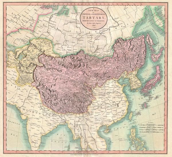
1806 map of independent Tartary (yellow) and Chinese Tartary(violet), drawn by John Cary.Tartary, al
1806 map of independent Tartary (yellow) and Chinese Tartary(violet), drawn by John Cary.Tartary, also known as Great Tartary, was mostly a blanket term forthe areas of Central and Inner Asia unknown to Europeancartographers. Although Japan & Tibet are included in ChineseTartary here, they were never a part of it.This map covers Central Asia from the Caspian Sea to Japan, north tothe Gulf of Ob, and south to India, Burma and the Philippines. Itincludes the modern nations of Uzbekistan, Kazakhstan, Turkmenistan,Kyrgyzstan, Tajikistan and Mongolia. Cary has attempted to show someof the Silk Road passages, especially to the north of the GobiDesert, but ultimately admits that “The Geography of these parts isextremely obscure.” -- source link
#history#cartography#maps#great tartary#chinese tartary#china#russia#japan#tibet#india#burma#philippines#uzbekistan#kazakhstan#turkmenistan#kyrgyzstan#tajikistan#mongolia#siberia#silk road#john cary
